

Land zones within Mulga Lands bioregion
List all regional ecosystems within Mulga Lands or list by land zone:
| Land zone | Land zone name | Image |
|---|---|---|
| Land zone 3 | Alluvium (river and creek flats) |  |
| Land zone 4 | Clay plains not associated with current alluvium |  |
| Land zone 5 | Old loamy and sandy plains |  |
| Land zone 6 | Inland dunefields |  |
| Land zone 7 | Ironstone jump-ups | 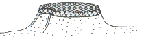 |
| Land zone 9 | Undulating country on fine grained sedimentary rocks | 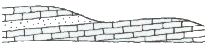 |
| Land zone 12 | Hills and lowlands on granitic rocks |  |
